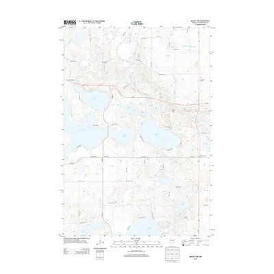
2013 Map of Mount Tom
USGS Topo · Published 2013About this map
Mount Tom rises as a prominent landmark in this lake-dominated region of Kandiyohi County, anchoring a landscape shaped by glacial depressions and contemporary agricultural drainage. The area is defined by an intricate network of water bodies, including the large basins of Norway Lake, Games Lake, and Andrew Lake, which are connected by a system of rural roads and state highways like MN-9. The agricultural character of the region is evident in the managed waterways of County Ditch Number 8 Three and County Ditch Number 8 Four, which facilitate drainage across the undulating terrain. Genealogists and local historians will find several burial sites preserved across the townships, including Colfax Cem in the northwest and Lake Florida Cem near the shores of Lake Florida. The presence of Sibley Park Rd near the central lakes indicates the area's long-standing role in regional recreation and conservation.
Find a feature on this map
54 named features on this map. Tap any name to fly to it.
Don’t see what you’re looking for? This feature index may not catch every label — zoom into the map to look around manually.
Map Details
Editions of this 2013 Mount Tom Map
This is the sole edition of this map. No revisions or reprints were ever made.
Other maps of this area
1953 · Saint Cloud
USGS Topo · 1:250,000
1956 · Atwater
USGS Topo · 1:62,500
1957 · Saint Cloud
USGS Topo · 1:250,000
1958 · Saint Cloud
USGS Topo · 1:250,000
1958 · Pennock
USGS Topo · 1:24,000
1958 · Solomon Lake
USGS Topo · 1:24,000
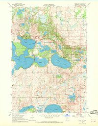
1967 · Mount Tom
USGS Topo · 1:24,000
1967 · Sunburg
USGS Topo · 1:24,000
1967 · Belgrade
USGS Topo · 1:24,000
1967 · Lake Johanna
USGS Topo · 1:24,000