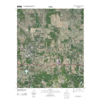
2013 Map of Mount Vernon
USGS Topo · Published 2013About this map
Mount Vernon serves as the central hub of this East Texas landscape, where the town's street grid meets the modern thoroughfares of Interstate 30 W and Interstate 30 E. The area's water management is a defining feature, illustrated by the Mount Vernon Municipal Reservoir and numerous small bodies of water like Deal Lake, Lake Ione, and Carpenter Lake. These reservoirs and the surrounding drainage basins of Bear Pen Creek and Ripley Creek reflect a landscape adapted for both municipal supply and rural utility.
Find a feature on this map
63 named features on this map. Tap any name to fly to it.
Don’t see what you’re looking for? This feature index may not catch every label — zoom into the map to look around manually.
Map Details
Editions of this 2013 Mount Vernon Map
This is the sole edition of this map. No revisions or reprints were ever made.
Other maps of this area

1953 · Texarkana
USGS Topo · 1:250,000

1956 · Texarkana
USGS Topo · 1:250,000

1963 · Mitchell Creek
USGS Topo · 1:24,000

1964 · Mount Vernon
USGS Topo · 1:24,000

1964 · Saltillo
USGS Topo · 1:24,000

1964 · Talco
USGS Topo · 1:24,000

1964 · Hagansport
USGS Topo · 1:24,000

1964 · Purley
USGS Topo · 1:24,000

1965 · Winfield
USGS Topo · 1:24,000

1965 · Monticello
USGS Topo · 1:24,000