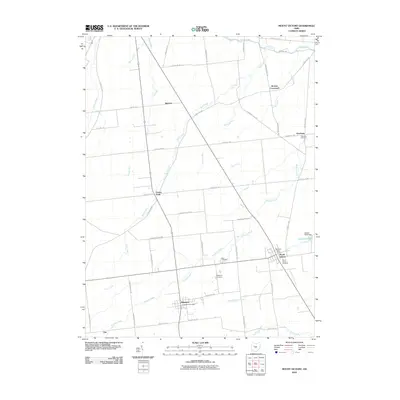
2010 Map of Mount Victory
USGS Topo · Published 2010About this map
Mount Victory and Ridgeway serve as the primary population centers in this rural Hardin County landscape, where the flat agricultural terrain is defined by a dense network of local township and county roads. The area's history is preserved through numerous family and community burial grounds, including Hale Cemetery, Otterbein Cemetery, and the Ridgeway Cemetery. Small crossroads and settlements like Grassy Point, Mentzer, and Otterbein punctuate the grid of farms, reflecting the early 21st-century rural layout. Hydrological features such as Panther Creek, Wolf Creek, and North Wildcat Creek drain the fields, while the Scioto River clips the northern edge of the survey. Significant local landmarks like the McVictory Post Office and the Ziegler Pond Dam provide specific points of interest for researchers studying the local infrastructure and community services of this Ohio region.
Find a feature on this map
53 named features on this map. Tap any name to fly to it.
Don’t see what you’re looking for? This feature index may not catch every label — zoom into the map to look around manually.
Map Details
Editions of this 2010 Mount Victory Map
This is the sole edition of this map. No revisions or reprints were ever made.
Other maps of this area

1913 · East Liberty
USGS Topo · 1:62,500

1913 · Richwood
USGS Topo · 1:62,500

1915 · Richwood
USGS Topo · 1:62,500

1915 · East Liberty
USGS Topo · 1:62,500

1915 · Kenton
USGS Topo · 1:62,500

1915 · La Rue
USGS Topo · 1:62,500

1944 · East Liberty
USGS Topo · 1:62,500

1944 · Kenton
USGS Topo · 1:62,500

1944 · Richwood
USGS Topo · 1:62,500

1950 · Marion
USGS Topo · 1:250,000