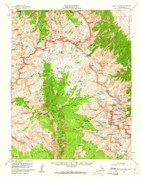
1956 Map of Mount Whitney
USGS Topo · Published 1961About this map
Mount Whitney dominates the eastern edge of this mid-century survey, marking the dramatic boundary where the Sierra Nevada falls away into the Inyo National Forest. The map documents a high-altitude wilderness defined by the Great Western Divide and the Kings-Kern Divide, where the upper reaches of the Kern Canyon separate Kings Canyon National Park from Sequoia National Park.
Find a feature on this map
117 named features on this map. Tap any name to fly to it.
Don’t see what you’re looking for? This feature index may not catch every label — zoom into the map to look around manually.
Map Details
Editions of this 1956 Mount Whitney Map
3 editions found

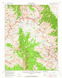
Other maps of this area

1903 · Tehipite
USGS Topo · 1:125,000

1904 · Kaweah
USGS Topo · 1:125,000

1905 · Tehipite
USGS Topo · 1:125,000

1905 · Olancha
USGS Topo · 1:125,000

1907 · Olancha
USGS Topo · 1:125,000

1907 · Mt. Whitney
USGS Topo · 1:125,000

1909 · Kaweah
USGS Topo · 1:125,000

1919 · Mt. Whitney
USGS Topo · 1:125,000

1937 · Mt. Whitney
USGS Topo · 1:125,000

1937 · Kaweah
USGS Topo · 1:125,000