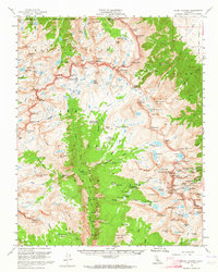
1956 Map of Mount Whitney
USGS Topo · Published 1964About this map
Kings Canyon National Park and Sequoia National Park meet in this high-altitude survey of the Sierra Nevada crest. The map documents the intricate network of high-elevation trails and camps during the mid-1950s, centered on the towering summit of Mount Whitney. The John Muir Trail is traced as it winds through glacial basins and over steep dividers like Forester Pass, illustrating the primitive transportation routes used by early rangers and mountaineers.
Find a feature on this map
135 named features on this map. Tap any name to fly to it.
Don’t see what you’re looking for? This feature index may not catch every label — zoom into the map to look around manually.
Map Details
Editions of this 1956 Mount Whitney Map
3 editions found

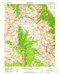
Other maps of this area

1903 · Tehipite
USGS Topo · 1:125,000

1904 · Kaweah
USGS Topo · 1:125,000

1905 · Tehipite
USGS Topo · 1:125,000

1905 · Olancha
USGS Topo · 1:125,000

1907 · Olancha
USGS Topo · 1:125,000

1907 · Mt. Whitney
USGS Topo · 1:125,000

1909 · Kaweah
USGS Topo · 1:125,000

1919 · Mt. Whitney
USGS Topo · 1:125,000

1937 · Mt. Whitney
USGS Topo · 1:125,000

1937 · Kaweah
USGS Topo · 1:125,000