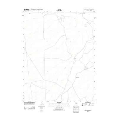
2012 Map of Mount Wilson
USGS Topo · Published 2012About this map
Craws Ranch sits as a singular point of settlement in this high-altitude landscape of eastern Nevada, where the desert gives way to the prominent summit of Mount Wilson. Water is the defining factor of this terrain, with a network of vital sources including Mountain View Spring, Eagle Spring, and Matley Spring scattered across the slopes. These water points, along with Taffery Spring and Rock Spring, likely served as crucial anchors for local ranching and transit through this corner of Lincoln County.
Find a feature on this map
19 named features on this map. Tap any name to fly to it.
Don’t see what you’re looking for? This feature index may not catch every label — zoom into the map to look around manually.
Map Details
Editions of this 2012 Mount Wilson Map
This is the sole edition of this map. No revisions or reprints were ever made.
Other maps of this area

1915 · Bristol Range
USGS Topo · 1:62,500

1917 · Bristol Range
USGS Topo · 1:62,500

1953 · Bristol Range SE
USGS Topo · 1:24,000

1956 · Lund
USGS Topo · 1:250,000

1960 · Lund
USGS Topo · 1:250,000
1970 · Mt. Wilson SW
USGS Topo · 1:24,000
1970 · Mt. Wilson
USGS Topo · 1:24,000

1970 · Pierson Summit
USGS Topo · 1:24,000

1970 · Parsnip Peak
USGS Topo · 1:24,000
1971 · Bristol Range NE
USGS Topo · 1:24,000