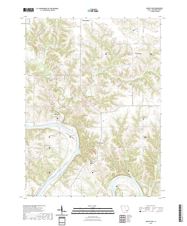
2022 Map of Mount Zion
USGS Topo · Published 2022About this map
The Des Moines River winds through this Van Buren County landscape, defining the topography of the Southern Iowa Drift Plain. Small communities and rural junctions like Mount Zion, Birmingham, Winchester, and Kilbourn are connected by a grid of local roads and historic trails such as King Trl and Juniper Trl. The map reveals a dense concentration of early burial sites and family plots, offering a glimpse into the 19th-century settlement pattern. Unique markers such as the Railroad Grave and the County Farm Cem stand alongside more traditional sites like Parkerville Cem and Miller Chapel Cem. The drainage network, including Lick Creek and Little Lick Cr, carves through the undulating terrain north of the river, where numerous cemeteries like Tedrow Cem and Topping Cem occupy the higher ridges.
Find a feature on this map
71 named features on this map. Tap any name to fly to it.
Don’t see what you’re looking for? This feature index may not catch every label — zoom into the map to look around manually.
Map Details
Editions of this 2022 Mount Zion Map
This is the sole edition of this map. No revisions or reprints were ever made.
Other maps of this area

1954 · Centerville
USGS Topo · 1:250,000

1957 · Centerville
USGS Topo · 1:250,000

1958 · Centerville
USGS Topo · 1:250,000

1958 · Burlington
USGS Topo · 1:250,000

1961 · Burlington
USGS Topo · 1:250,000

1963 · Burlington
USGS Topo · 1:250,000
1965 · Libertyville
USGS Topo · 1:24,000

1965 · Douds
USGS Topo · 1:24,000

1968 · Bonaparte
USGS Topo · 1:24,000

1968 · Keosauqua
USGS Topo · 1:24,000