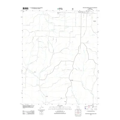
2012 Map of Mountain Grove South
USGS Topo · Published 2012About this map
Prior and Goodville anchor the rural landscape of southern Missouri in this 2012 topographic record. The area is defined by a dense network of watercourses, including Whetstone Creek and Fox Creek, which carve through the terrain south of Mountain Grove. Land use is reflected in the distribution of family and community landmarks, such as Strunk Cemetery, Livingston Cemetery, and Prior Cemetery, providing valuable data for genealogical research in this portion of Douglas County. The northern edge of the map features the Mountain Grove Memorial Airport and Lily Lake, marking the transition from the city's outskirts into the more remote forested and agricultural lands. Prominent natural features like Bald Knob Mountain stand out against the drainage basins of Clifty Creek and its western prong, showing the complex topography that has shaped settlement patterns and road placements like Highway ZZ over decades.
Find a feature on this map
48 named features on this map. Tap any name to fly to it.
Don’t see what you’re looking for? This feature index may not catch every label — zoom into the map to look around manually.
Map Details
Editions of this 2012 Mountain Grove South Map
This is the sole edition of this map. No revisions or reprints were ever made.
Other maps of this area

1937 · Buckhart
USGS Topo · 1:48,000

1939 · Topaz
USGS Topo · 1:62,500

1941 · Topaz
USGS Topo · 1:62,500

1943 · Buckhart
USGS Topo · 1:62,500

1945 · Harrison
USGS Topo · 1:250,000

1945 · Buckhart
USGS Topo · 1:62,500

1949 · Harrison
USGS Topo · 1:250,000

1950 · Cabool SW
USGS Topo · 1:24,000

1951 · Norwood
USGS Topo · 1:24,000

1951 · Mountain Grove South
USGS Topo · 1:24,000