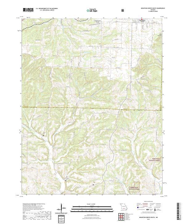
2021 Map of Mountain Grove South
USGS Topo · Published 2021About this map
Mountain Grove occupies the northern edge of this Ozark plateau landscape, where the southern reaches of the town give way to the headwaters of several key drainage systems. The terrain is defined by the winding paths of Whetstone Cr, Fox Cr, and Clifty Cr, which carve through the plateau towards the Mark Twain National Forest in the southeast. For local historians, the placement of Strunk Cem, Livingston Cem, and Prior Cem provides a clear view of the area's rural settlement pattern, often situated near the divides between creek branches like the E Prong Fox Cr. The map captures the interface between managed timberlands and private agricultural holdings, connected by a network of county roads such as Whetstone Rd and State Hwy ZZ. The Mountain Grove Memorial Airport stands as a modern landmark amidst these traditional land divisions.
Find a feature on this map
32 named features on this map. Tap any name to fly to it.
Don’t see what you’re looking for? This feature index may not catch every label — zoom into the map to look around manually.
Map Details
Editions of this 2021 Mountain Grove South Map
This is the sole edition of this map. No revisions or reprints were ever made.
Other maps of this area

1937 · Buckhart
USGS Topo · 1:48,000

1939 · Topaz
USGS Topo · 1:62,500

1941 · Topaz
USGS Topo · 1:62,500

1943 · Buckhart
USGS Topo · 1:62,500

1945 · Harrison
USGS Topo · 1:250,000

1945 · Buckhart
USGS Topo · 1:62,500

1949 · Harrison
USGS Topo · 1:250,000

1950 · Cabool SW
USGS Topo · 1:24,000

1951 · Norwood
USGS Topo · 1:24,000

1951 · Mountain Grove South
USGS Topo · 1:24,000