
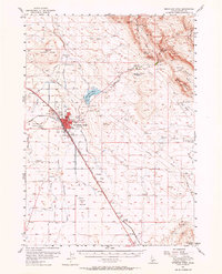
1956 Map of Mountain Home
USGS Topo · Published 1958About this map
Mountain Home serves as the focal point of this mid-century Idaho landscape, centered at the junction of modern infrastructure and pioneer routes. The town is flanked by essential community landmarks including Elmore Memorial Hospital, Mtn View Cemetery, and the Golf Driving Range. Beyond the residential core, the map captures the transition from irrigated agricultural lands to the high desert terrain of the Snake River Plain, where the Union Pacific railroad and the Oregon Short Line define the corridor of transit and trade.
Find a feature on this map
49 named features on this map. Tap any name to fly to it.
Don’t see what you’re looking for? This feature index may not catch every label — zoom into the map to look around manually.
Map Details
Editions of this 1956 Mountain Home Map
2 editions found
Other maps of this area

1892 · Mountain Home
USGS Topo · 1:125,000

1892 · Camas Prairie
USGS Topo · 1:125,000

1893 · Mountain Home
USGS Topo · 1:125,000

1893 · Camas Prairie
USGS Topo · 1:125,000

1947 · Bruneau
USGS Topo · 1:62,500

1947 · Indian Cove
USGS Topo · 1:24,000

1947 · Hammett
USGS Topo · 1:24,000

1947 · Sand Dunes
USGS Topo · 1:24,000

1947 · Bruneau
USGS Topo · 1:24,000

1948 · Sand Dunes
USGS Topo · 1:24,000