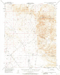
1953 Map of Mountain Springs Canyon
USGS Topo · Published 1963About this map
The Coso Range and the high desert basins of Eastern California are meticulously documented in this mid-century topographic record, reflecting an era of military expansion and persistent mineral exploration. The presence of the Naval Air Test Station occupying the central Coso Basin and Indian Wells Valley highlights the strategic importance of this terrain for aviation development.
Find a feature on this map
32 named features on this map. Tap any name to fly to it.
Don’t see what you’re looking for? This feature index may not catch every label — zoom into the map to look around manually.
Map Details
Editions of this 1953 Mountain Springs Canyon Map
4 editions found

Other maps of this area

1908 · Ballarat
USGS Topo · 1:250,000

1913 · Ballarat
USGS Topo · 1:250,000

1915 · Searles Lake
USGS Topo · 1:250,000

1943 · Inyokern
USGS Topo · 1:62,500

1947 · Trona
USGS Topo · 1:250,000

1948 · Trona
USGS Topo · 1:250,000

1948 · Death Valley
USGS Topo · 1:250,000

1949 · Trona
USGS Topo · 1:62,500

1949 · Searles Lake
USGS Topo · 1:62,500

1950 · Searles Lake
USGS Topo · 1:62,500