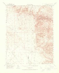
1953 Map of Mountain Springs Canyon
USGS Topo · Published 1973About this map
Volcano Butte and the rugged peaks of the Coso Range dominate this high-desert landscape in the early 1950s. The map illustrates a complex network of canyons and washes, including Petroglyph Wash and Renegade Canyon, that drain into the Coso Basin and the southern Indian Wells Valley. Traces of human activity are concentrated in the arid lowlands and canyon floors, most notably at the Paxton Ranch (Site) and along the established Darwin Road.
Find a feature on this map
27 named features on this map. Tap any name to fly to it.
Don’t see what you’re looking for? This feature index may not catch every label — zoom into the map to look around manually.
Map Details
Editions of this 1953 Mountain Springs Canyon Map
4 editions found

Other maps of this area

1908 · Ballarat
USGS Topo · 1:250,000

1913 · Ballarat
USGS Topo · 1:250,000

1915 · Searles Lake
USGS Topo · 1:250,000

1943 · Inyokern
USGS Topo · 1:62,500

1947 · Trona
USGS Topo · 1:250,000

1948 · Trona
USGS Topo · 1:250,000

1948 · Death Valley
USGS Topo · 1:250,000

1949 · Trona
USGS Topo · 1:62,500

1949 · Searles Lake
USGS Topo · 1:62,500

1950 · Searles Lake
USGS Topo · 1:62,500