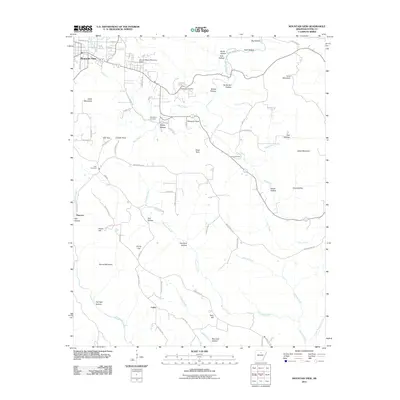
2011 Map of Mountain View
USGS Topo · Published 2011About this map
Mountain View sits at the northwestern edge of this landscape, where the street grid of the county seat transitions into the complex drainage systems of the Ozark foothills. The map reveals a rural community defined by named landmarks and family-associated hollows, such as Ike Brown Hollow and Hanes Hollow. High ground is marked by prominent features like Cedar Mountain and Irons Mountain, while the lowlands are carved by the intricate paths of Rocky Bayou, Cove Prong, and Raccoon Creek.
Find a feature on this map
83 named features on this map. Tap any name to fly to it.
Don’t see what you’re looking for? This feature index may not catch every label — zoom into the map to look around manually.
Map Details
Editions of this 2011 Mountain View Map
This is the sole edition of this map. No revisions or reprints were ever made.
Other maps of this area

1890 · Batesville
USGS Topo · 1:125,000

1891 · Batesville
USGS Topo · 1:125,000

1892 · Mountain View
USGS Topo · 1:125,000

1894 · Mountain View
USGS Topo · 1:125,000

1953 · Memphis
USGS Topo · 1:250,000

1956 · Memphis
USGS Topo · 1:250,000

1956 · Russellville
USGS Topo · 1:250,000

1964 · Russellville
USGS Topo · 1:250,000
1964 · Guion
USGS Topo · 1:24,000
1964 · Sylamore
USGS Topo · 1:24,000