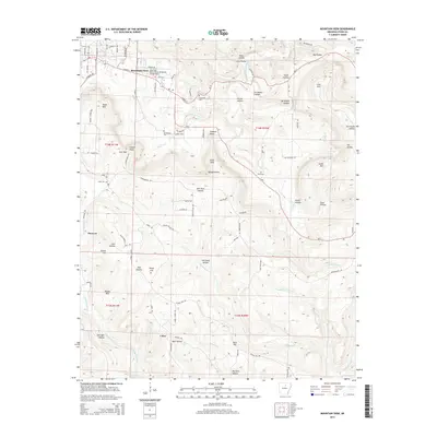
2014 Map of Mountain View
USGS Topo · Published 2014About this map
Mountain View serves as the focal point of this Ozark plateau survey, where the town grid meets the winding courses of White River and Rocky Bayou. The landscape is defined by a dense network of hollows and ridges, with Irons Mtn and Dodd Mtn overlooking the valleys. In the southern portion of the quadrangle, the small settlements of Hanover and Luber are situated along the drainages of Tomahawk Creek and Raccoon Creek. The infrastructure of the era is marked by the Mountain View Wilcox Memorial Field Airport and several historic burial sites, including Flatwoods Cemetery and Whitefield Cemetery. The terrain is deeply incised by numerous waterways such as Mill Prong and Cove Prong, creating a complex system of "hollows" like Ripley Hollow and Big Hollow that have historically dictated the placement of roads and homesteads.
Find a feature on this map
109 named features on this map. Tap any name to fly to it.
Don’t see what you’re looking for? This feature index may not catch every label — zoom into the map to look around manually.
Map Details
Editions of this 2014 Mountain View Map
This is the sole edition of this map. No revisions or reprints were ever made.
Other maps of this area

1890 · Batesville
USGS Topo · 1:125,000

1891 · Batesville
USGS Topo · 1:125,000

1892 · Mountain View
USGS Topo · 1:125,000

1894 · Mountain View
USGS Topo · 1:125,000

1953 · Memphis
USGS Topo · 1:250,000

1956 · Memphis
USGS Topo · 1:250,000

1956 · Russellville
USGS Topo · 1:250,000

1964 · Russellville
USGS Topo · 1:250,000
1964 · Guion
USGS Topo · 1:24,000
1964 · Sylamore
USGS Topo · 1:24,000