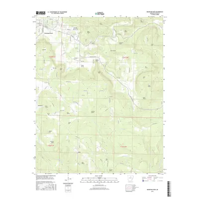
2017 Map of Mountain View
USGS Topo · Published 2017About this map
Mountain View serves as the primary hub in this portion of the Ozark foothills, characterized by a complex network of ridges and hollows that define local travel and settlement. The town is anchored by Mountain View Wilcox Memorial Field and a grid of streets including E Main St and W Washington St, transitioning quickly into the deep drainage basins of Rocky Bayou and Mill Prong. To the south, the smaller communities of Hanover and Luber are situated among prominent terrain features like Dodd Mtn and Kemp Hill. For those tracing family histories in Stone County, the map identifies several rural burial grounds such as Whitefield Cem and Case Cem. The landscape is heavily dissected by numerous named hollows, including Ripley Hollow and Hanes Hollow, illustrating how the physical geography of the White River hills dictated the placement of roads like Misenheimer Rd and Flat Rock Rd.
Find a feature on this map
119 named features on this map. Tap any name to fly to it.
Don’t see what you’re looking for? This feature index may not catch every label — zoom into the map to look around manually.
Map Details
Editions of this 2017 Mountain View Map
This is the sole edition of this map. No revisions or reprints were ever made.
Other maps of this area

1890 · Batesville
USGS Topo · 1:125,000

1891 · Batesville
USGS Topo · 1:125,000

1892 · Mountain View
USGS Topo · 1:125,000

1894 · Mountain View
USGS Topo · 1:125,000

1953 · Memphis
USGS Topo · 1:250,000

1956 · Memphis
USGS Topo · 1:250,000

1956 · Russellville
USGS Topo · 1:250,000

1964 · Russellville
USGS Topo · 1:250,000
1964 · Guion
USGS Topo · 1:24,000
1964 · Sylamore
USGS Topo · 1:24,000