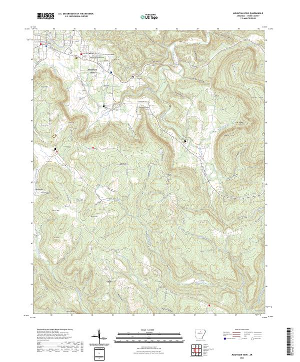
2024 Map of Mountain View
USGS Topo · Published 2024About this map
The Stone County Courthouse serves as the central anchor for Mountain View, a community defined by its complex network of hollers and ridges in the Ozark landscape. Beyond the town center, smaller settlements like Hanover and Luber are connected by winding routes such as Mountain View Rd and Misenheimer Rd. The area’s geography is deeply incised by numerous waterways including Rocky Bayou, Mill Prong, and the winding Raccoon Creek, which carve through prominent elevations like Dodd Mtn and Tater Hill. Local family history is preserved in several rural burial sites, including Flatwoods Cem and Case Cem, scattered among the timbered slopes. The presence of Mountain View Wilcox Memorial Field and the surrounding township boundaries of t14n r11w and t13n r10w illustrate the contemporary administrative and transport structure of this part of Stone County.
Find a feature on this map
75 named features on this map. Tap any name to fly to it.
Don’t see what you’re looking for? This feature index may not catch every label — zoom into the map to look around manually.
Map Details
Editions of this 2024 Mountain View Map
This is the sole edition of this map. No revisions or reprints were ever made.
Other maps of this area

1890 · Batesville
USGS Topo · 1:125,000

1891 · Batesville
USGS Topo · 1:125,000

1892 · Mountain View
USGS Topo · 1:125,000

1894 · Mountain View
USGS Topo · 1:125,000

1953 · Memphis
USGS Topo · 1:250,000

1956 · Memphis
USGS Topo · 1:250,000

1956 · Russellville
USGS Topo · 1:250,000

1964 · Russellville
USGS Topo · 1:250,000
1964 · Guion
USGS Topo · 1:24,000
1964 · Sylamore
USGS Topo · 1:24,000