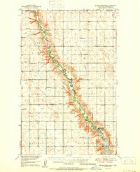
1950 Map of Mouse River Park
USGS Topo · Published 1950About this map
The Souris River meanders deeply through Renville County in this mid-century survey, carving a distinct valley through the townships of Stafford, Prosperity, and Grover. This landscape is characterized by its orderly grid of section lines, dotted with local landmarks like Edson Ch and Prosperity Ch. The map documents the early years of the Upper Souris National Wildlife Refuge, which follows the river's path northward toward the boundary of Canada.
Find a feature on this map
30 named features on this map. Tap any name to fly to it.
Don’t see what you’re looking for? This feature index may not catch every label — zoom into the map to look around manually.
Map Details
Editions of this 1950 Mouse River Park Map
2 editions found
Other maps of this area

1947 · Tolley
USGS Topo · 1:62,500

1948 · Kenmare
USGS Topo · 1:24,000

1948 · Norma
USGS Topo · 1:24,000

1948 · Mouse River Park NW
USGS Topo · 1:24,000

1948 · Tolley
USGS Topo · 1:24,000

1949 · Mohall SW
USGS Topo · 1:24,000

1949 · Mouse River Park NW
USGS Topo · 1:24,000

1949 · Bowbells SE
USGS Topo · 1:24,000

1949 · Sherwood
USGS Topo · 1:24,000

1949 · Greene
USGS Topo · 1:24,000