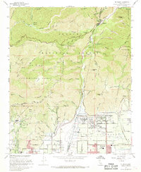
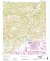
1967 Map of Mt. Baldy
USGS Topo · Published 1968About this map
Mt Baldy and the high peaks of the Angeles National Forest dominate this landscape, illustrating the sharp transition from the residential grid of Upland and Claremont to the steep wilderness of the San Gabriel Mountains. The map reveals a complex water management infrastructure essential to the region's development, centered on the San Antonio Dam and its expansive Percolation Basin and percolation basins. Local cultural and educational history is anchored by the Padua Hills Theater and schools like the Girls Collegiate Sch. High-altitude settlements and camps such as Barrett and Thompson Ranch are connected by the winding Mt Baldy Road and Glendora Ridge Road. The inclusion of the San Dimas Experimental Forest and Cucamonga Wilderness highlights the era's focus on forest management and watershed protection as suburban growth pressed against the mountain foothills.
Find a feature on this map
65 named features on this map. Tap any name to fly to it.
Don’t see what you’re looking for? This feature index may not catch every label — zoom into the map to look around manually.
Map Details
Editions of this 1967 Mt. Baldy Map
5 editions found
Other maps of this area

1894 · Pomona
USGS Topo · 1:62,500

1897 · Pomona
USGS Topo · 1:62,500

1897 · Cucamonga
USGS Topo · 1:62,500

1898 · Pomona
USGS Topo · 1:62,500

1900 · Cucamonga
USGS Topo · 1:62,500

1901 · Southern California Sheet No. 1
USGS Topo · 1:250,000

1903 · Rock Creek
USGS Topo · 1:62,500

1903 · Cucamonga
USGS Topo · 1:62,500

1903 · San Antonio
USGS Topo · 1:62,500

1904 · Pomona
USGS Topo · 1:62,500