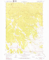
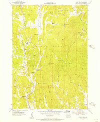
1955 Map of Mt. Coolidge
USGS Topo · Published 1979About this map
Mt. Coolidge dominates this section of the Black Hills, serving as a high-altitude landmark topped by a Lookout Tower. The 1955 survey reveals a complex landscape of protected lands where the Custer State Park, Black Hills National Forest, and Wind Cave National Park converge. This overlap of jurisdictional boundaries highlights the mid-century priority of conservation and resource management in South Dakota. Small outposts like Blue Bell and Galena provide focal points for human activity amidst a dense network of drainages, including the headwaters of the North Fork Lame Johnny Creek and the South Fork Lame Johnny Creek. The terrain is defined by dramatic elevation changes, notably toward Rankin Ridge, where the map details the rugged hydrology of French Creek and Flynn Creek.
Find a feature on this map
19 named features on this map. Tap any name to fly to it.
Don’t see what you’re looking for? This feature index may not catch every label — zoom into the map to look around manually.
Map Details
Editions of this 1955 Mt. Coolidge Map
5 editions found
Other maps of this area

1894 · Hermosa
USGS Topo · 1:125,000

1896 · Harney Peak
USGS Topo · 1:125,000

1901 · Hermosa
USGS Topo · 1:125,000

1901 · Harney Peak
USGS Topo · 1:125,000

1954 · Iron Mountain
USGS Topo · 1:24,000

1954 · Custer
USGS Topo · 1:24,000

1954 · Hayward
USGS Topo · 1:24,000

1954 · Mount Rushmore
USGS Topo · 1:62,500

1955 · Mt. Coolidge
USGS Topo · 1:24,000
1955 · Cicero Peak
USGS Topo · 1:24,000