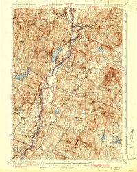
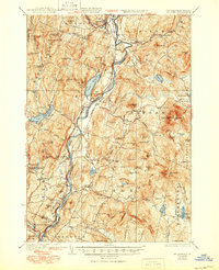
1933 Map of Mt. Cube
USGS Topo · Published 1943About this map
The Connecticut River serves as the central artery of this early 1930s survey, dividing the riverside communities of Vermont and New Hampshire. On the eastern banks, the Dartmouth College Road and the Boston and Maine RR parallel the water, connecting settlements like Orford and Piermont to the wider region. The landscape is dotted with small local institutions, including the Mt Cube Sch and Chesley Sch, which speak to the rural schoolhouse network that once served these upland farm communities before mid-century consolidation.
Find a feature on this map
119 named features on this map. Tap any name to fly to it.
Don’t see what you’re looking for? This feature index may not catch every label — zoom into the map to look around manually.
Map Details
Editions of this 1933 Mt. Cube Map
6 editions found

Other maps of this area

1896 · Strafford
USGS Topo · 1:62,500

1906 · Hanover
USGS Topo · 1:62,500

1908 · Hanover
USGS Topo · 1:62,500

1927 · Cardigan
USGS Topo · 1:62,500

1927 · Mascoma
USGS Topo · 1:62,500

1928 · Rumney
USGS Topo · 1:62,500

1929 · Moosilauke
USGS Topo · 1:62,500

1930 · Cardigan
USGS Topo · 1:62,500

1931 · Mt. Cube
USGS Topo · 1:62,500

1931 · Woodsville
USGS Topo · 1:48,000