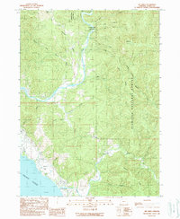
1989 Map of Mt. Emily
USGS Topo · Published 1989About this map
The Chetco River and Winchuck River dominate this coastal landscape in the late 1980s, carving deep drainage patterns through the Siskiyou National Forest. Along the northern reaches of the Chetco, Alfred A Loeb State Park preserves the riverfront near the confluence with the North Fork Chetco River. The interior is defined by sharp topographic features like Boar Backbone and Gardner Ridge, which provided the backdrop for extractive efforts at the Mt Emily Prospect Mine. Near the coastline, the small settlement of McVay sits above the Pacific Ocean, characterized by distinctive offshore landmarks such as McVay Rock and Camel Rock. This survey captures the transition from the timber-rich national forest ridges down to the alluvial river mouths and the rugged Oregon shoreline.
Find a feature on this map
31 named features on this map. Tap any name to fly to it.
Don’t see what you’re looking for? This feature index may not catch every label — zoom into the map to look around manually.
Map Details
Editions of this 1989 Mt. Emily Map
This is the sole edition of this map. No revisions or reprints were ever made.
Other maps of this area

1929 · Crescent City
USGS Topo · 1:125,000

1945 · Point St. George
USGS Topo · 1:62,500

1949 · Eureka
USGS Topo · 1:250,000

1952 · Crescent City
USGS Topo · 1:62,500

1954 · Coos Bay
USGS Topo · 1:250,000

1954 · Cape Ferrelo
USGS Topo · 1:62,500

1954 · Mt. Emily
USGS Topo · 1:62,500

1956 · Smith River
USGS Topo · 1:24,000

1958 · Eureka
USGS Topo · 1:250,000

1958 · Coos Bay
USGS Topo · 1:250,000