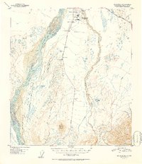
1952 Map of Mt. Hayes D-4
USGS Topo · Published 1952About this map
Big Delta Arctic Training Center dominates the northern corridor of this 1952 Alaskan interior survey, reflecting the strategic military footprint in the region during the early Cold War. The landscape is defined by the braided path of the Delta River and the convergence of vital transport routes, including the Alaska Highway and the Richardson Highway. Just south of the military installation, the map records Beales Cache and several survey points like Beales North Base, providing specific landmarks for those tracing the development of regional infrastructure.
Find a feature on this map
22 named features on this map. Tap any name to fly to it.
Don’t see what you’re looking for? This feature index may not catch every label — zoom into the map to look around manually.
Map Details
Editions of this 1952 Mt. Hayes D-4 Map
2 editions found

Other maps of this area

1950 · Mount Hayes
USGS Topo · 1:250,000

1950 · Big Delta
USGS Topo · 1:250,000

1950 · Big Delta A-5
USGS Topo · 1:63,360

1950 · Mount Hayes D-4
USGS Topo · 1:63,360

1950 · Mount Hayes C-4
USGS Topo · 1:63,360

1950 · Big Delta A-4
USGS Topo · 1:63,360

1950 · Mount Hayes D-5
USGS Topo · 1:63,360

1951 · Big Delta
USGS Topo · 1:250,000

1951 · Mount Hayes
USGS Topo · 1:250,000

1951 · Mount Hayes C-5
USGS Topo · 1:63,360