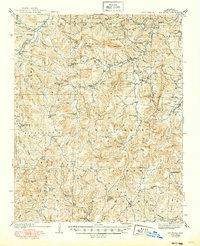
1940 Map of Mt Judea
USGS Topo · Published 1949About this map
The Buffalo River winds through the heart of this Arkansas landscape, carving a deep valley that defines the settlement patterns of Newton County. In the early 1930s, when these surveys were first conducted, the area was a network of high ridges like Moss Mountain and Big Hudson Mountain separated by narrow hollows where small communities took root. Central to this topography is Mt Judea, surrounded by family-named landmarks and rural institutions such as Coal Hill Ch and Macedonia Sch.
Find a feature on this map
100 named features on this map. Tap any name to fly to it.
Don’t see what you’re looking for? This feature index may not catch every label — zoom into the map to look around manually.
Map Details
Editions of this 1940 Mt Judea Map
3 editions found

Other maps of this area

1879 · Washington
USGS Topo · 1:62,500

1887 · Smyrna
USGS Topo · 1:62,500

1889 · Treat
USGS Topo · 1:62,500

1889 · Marshall #3
USGS Topo · 1:62,500

1889 · Ozone
USGS Topo · 1:62,500

1892 · Marshall
USGS Topo · 1:125,000

1893 · Yellville
USGS Topo · 1:125,000

1894 · Marshall
USGS Topo · 1:125,000

1901 · Marshall
USGS Topo · 1:125,000

1903 · Yellville
USGS Topo · 1:125,000