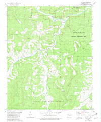
1980 Map of Mt Judea
USGS Topo · Published 1981About this map
Big Creek and its many tributaries, such as Left Fork Big Creek and Dry Branch, carve through the deep valley systems of the Ozarks in this 1980 survey. The settlement pattern follows these watercourses, with small communities like Mt Judea and Vendor anchored by local institutions including the Mt Judea Cemetery and Big Creek Church. Further north, Piercetown serves as a local hub near the Buffalo National River, which dominates the northern landscape alongside the Buffalo River State Wildlife Management Area.
Find a feature on this map
49 named features on this map. Tap any name to fly to it.
Don’t see what you’re looking for? This feature index may not catch every label — zoom into the map to look around manually.
Map Details
Editions of this 1980 Mt Judea Map
2 editions found
Other maps of this area

1892 · Marshall
USGS Topo · 1:125,000

1893 · Yellville
USGS Topo · 1:125,000

1894 · Marshall
USGS Topo · 1:125,000

1901 · Marshall
USGS Topo · 1:125,000

1903 · Yellville
USGS Topo · 1:125,000

1904 · Harrison
USGS Topo · 1:125,000

1905 · Harrison
USGS Topo · 1:125,000

1905 · Yellville
USGS Topo · 1:125,000

1929 · Yellville
USGS Topo · 1:125,000

1933 · Mt Judea
USGS Topo · 1:62,500