1951 Map of Mt. Katmai B-1
USGS Topo · Published 1978About this map
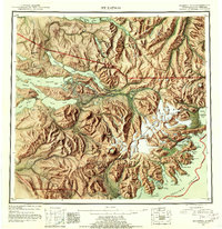
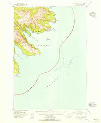
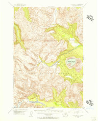
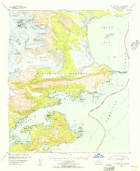
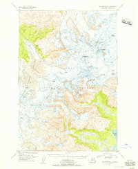
Katmai National Monument dominates this coastal landscape, where the ice of the Hook Glacier and Hallo Glacier meets the tidal waters of Shelikof Strait. The terrain is characterized by dramatic elevations like the Devils Desk, which overlooks a shoreline of intricate inlets and islands. Along the coast, significant landmarks such as Cape Nukshak and Cape Ugyak frame the entrances to Hallo Bay and Kukak Bay.\n\nThe map reveals a dynamic environment of shifting sediments, with extensive areas of Sand and Mud and Tidal Flat deposits near the mouth of the Ninagiak River. Island clusters, including Ninagiak Island, Aguligik Island, and Aguchik Island, are carefully charted alongside coastal features like Devils Cove and Kaflia Bay, providing a detailed record of this remote Alaskan coastline in the mid-20th century.
Find a feature on this map
31 named features on this map. Tap any name to fly to it.
Don’t see what you’re looking for? This feature index may not catch every label — zoom into the map to look around manually.
Map Details
Editions of this 1951 Mt. Katmai B-1 Map
3 editions found

Other maps of this area

1948 · Mt Katmai
USGS Topo · 1:250,000
1951 · Mt Katmai
USGS Topo · 1:250,000
1951 · Afognak C-6
USGS Topo · 1:63,360
1951 · Mount Katmai A-2
USGS Topo · 1:63,360
1951 · Mount Katmai A-1
USGS Topo · 1:63,360

1951 · Mount Katmai C-2
USGS Topo · 1:63,360
1951 · Mount Katmai C-1
USGS Topo · 1:63,360
1951 · Mount Katmai B-1
USGS Topo · 1:63,360
1951 · Mount Katmai B-2
USGS Topo · 1:63,360

1952 · Afognak
USGS Topo · 1:250,000