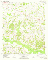
1971 Map of Mt. Pleasant
USGS Topo · Published 1973About this map
The Tennessee Mississippi Line bisects the northern reaches of this rural landscape, marking the transition between Fayette County, Tennessee, and Marshall County, Mississippi. In the early 1970s, this area was defined by a dense network of small communities and family landmarks concentrated along the drainage of the Coldwater River. Mt Pleasant stands as the primary settlement on the eastern edge, while the western portion is anchored by Cayce and New Salem. The distribution of local landmarks like Royal Chapel and New Sharron Ch suggests a deeply rooted community structure tied to the land. Genealogists will find particular value in the numerous small burial grounds noted across the terrain, including Benton Cem, King Cem, and Brittenum Cem. The map illustrates the hydrological patterns of the region, where Little Coldwater Creek and Oppossum Creek feed into the larger river systems that define the local topography.
Find a feature on this map
28 named features on this map. Tap any name to fly to it.
Don’t see what you’re looking for? This feature index may not catch every label — zoom into the map to look around manually.
Map Details
Editions of this 1971 Mt. Pleasant Map
This is the sole edition of this map. No revisions or reprints were ever made.
Other maps of this area

1943 · Collierville
USGS Topo · 1:62,500

1948 · Byhalia
USGS Topo · 1:62,500

1949 · Moscow
USGS Topo · 1:62,500

1953 · Holly Springs
USGS Topo · 1:62,500

1953 · Collierville
USGS Topo · 1:50,000

1956 · Blytheville
USGS Topo · 1:250,000

1956 · Tupelo
USGS Topo · 1:250,000

1958 · Tupelo
USGS Topo · 1:250,000

1959 · Blytheville
USGS Topo · 1:250,000

1965 · Rossville
USGS Topo · 1:24,000