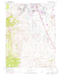
1969 Map of Mt. Rose NE
USGS Topo · Published 1977About this map
The southern fringes of Reno expand toward the high desert floor in this late 1960s survey, showing a landscape in transition from ranching to suburban development. The Reno Corporate Boundary cuts through the northern portion of the map, encompassing the Reno International Airport and the recreational waters of Virginia Lake. South of the city limits, the terrain descends from the timbered heights of the Toiyabe National Forest through a series of prominent drainages, including Whites Creek and Evans Creek.
Find a feature on this map
36 named features on this map. Tap any name to fly to it.
Don’t see what you’re looking for? This feature index may not catch every label — zoom into the map to look around manually.
Map Details
Editions of this 1969 Mt. Rose NE Map
4 editions found
Other maps of this area

1891 · Carson
USGS Topo · 1:125,000

1891 · Reno
USGS Topo · 1:125,000

1893 · Carson
USGS Topo · 1:125,000

1893 · Reno
USGS Topo · 1:125,000

1950 · Virginia City
USGS Topo · 1:62,500

1950 · Mt. Rose
USGS Topo · 1:62,500

1950 · Reno
USGS Topo · 1:62,500

1951 · Reno
USGS Topo · 1:62,500

1952 · Mt. Rose
USGS Topo · 1:62,500

1952 · Virginia City
USGS Topo · 1:62,500