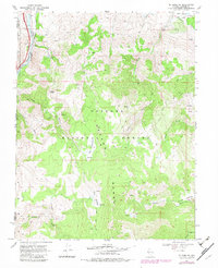
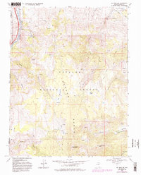
1968 Map of Mt. Rose NW
USGS Topo · Published 1983About this map
The Carson Range dominates this landscape along the California Nevada border, where the Truckee River carves through the northwestern corner. The area’s water management history is visible through the Steamboat Ditch and Golden Ditch, which trace the contours of the high desert terrain. Within the Toiyabe National Forest, the map records a network of high-altitude water sources including Fuller Lake, Hunter Lake, and the Big Meadows Springs. Industrial and transit activity centers around the Southern Pacific railroad line and a Quarry near the riverbanks. The rugged interior is accessible only by the Mt Rose Trail and various jeep tracks, climbing toward landmarks like Cone Peak and traversing remote basins such as Deep Canyon and Pony Dip Canyon.
Find a feature on this map
32 named features on this map. Tap any name to fly to it.
Don’t see what you’re looking for? This feature index may not catch every label — zoom into the map to look around manually.
Map Details
Editions of this 1968 Mt. Rose NW Map
5 editions found
Other maps of this area

1890 · Sierraville
USGS Topo · 1:125,000

1891 · Carson
USGS Topo · 1:125,000

1891 · Truckee
USGS Topo · 1:125,000

1891 · Reno
USGS Topo · 1:125,000

1892 · Sierraville
USGS Topo · 1:125,000

1893 · Carson
USGS Topo · 1:125,000

1893 · Truckee
USGS Topo · 1:125,000

1893 · Reno
USGS Topo · 1:125,000

1894 · Sierraville
USGS Topo · 1:125,000

1895 · Truckee
USGS Topo · 1:125,000