
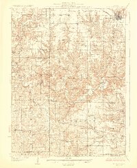
1929 Map of Mt Sterling
USGS Topo · Published 1929About this map
Mt Sterling anchors the northeastern corner of this landscape, where the Wabash railroad line cuts through the prairie before the terrain descends into the broken drainage of the McKee Creek system. The map reveals a high density of rural institutions, particularly one-room schoolhouses like Pea Green Sch, Mound Sch, and Friendly Sch, which served the farming families of Lee and Buckhorn townships. This 1920s topography highlights a transition from the flat agricultural uplands to the dissected creek valleys where river crossings were essential for travel between Brown Co and Pike Co.
Find a feature on this map
72 named features on this map. Tap any name to fly to it.
Don’t see what you’re looking for? This feature index may not catch every label — zoom into the map to look around manually.
Map Details
Editions of this 1929 Mt Sterling Map
2 editions found
Other maps of this area

1923 · Rushville
USGS Topo · 1:62,500

1924 · Griggsville
USGS Topo · 1:62,500

1925 · Liberty
USGS Topo · 1:62,500

1926 · Griggsville
USGS Topo · 1:62,500

1926 · Pittsfield
USGS Topo · 1:62,500

1926 · Rushville
USGS Topo · 1:62,500

1926 · Mt Sterling
USGS Topo · 1:62,500

1927 · Liberty
USGS Topo · 1:62,500

1928 · Meredosia
USGS Topo · 1:62,500

1931 · Barry
USGS Topo · 1:62,500