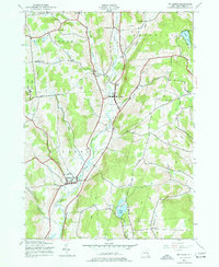
1943 Map of Mt Vision
USGS Topo · Published 1977About this map
Otego Creek and its many tributaries, including West Branch Otego Creek and Pool Brook, carve through the complex topography of Otsego County. During the early 1940s, this region maintained a deeply rural character, evidenced by the high density of small district schools such as School No 11, School No 5, and School No 13 scattered across the townships of Hartwick and Laurens. The village of Laurens serves as a primary hub in the south, while the western edge is defined by the recreational lands of Gilbert Lake State Park. Genealogists will find significant value in the distribution of family-named landmarks and burial grounds like Babcock Cem and Tiffany Cem. The landscape is a network of winding roads like Dutch Hill Road and Milford Road that connect isolated settlements like Lena and South Hartwick to the larger valleys.
Find a feature on this map
42 named features on this map. Tap any name to fly to it.
Don’t see what you’re looking for? This feature index may not catch every label — zoom into the map to look around manually.
Map Details
Editions of this 1943 Mt Vision Map
5 editions found
Other maps of this area

1907 · Cooperstown
USGS Topo · 1:62,500

1909 · Cooperstown
USGS Topo · 1:62,500

1909 · Delhi
USGS Topo · 1:62,500

1910 · Hartwick
USGS Topo · 1:62,500

1911 · Delhi
USGS Topo · 1:62,500

1912 · Hartwick
USGS Topo · 1:62,500

1915 · Oneonta
USGS Topo · 1:62,500

1918 · Oneonta
USGS Topo · 1:62,500

1943 · Mt Vision
USGS Topo · 1:24,000

1943 · Milford
USGS Topo · 1:24,000