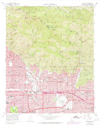
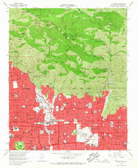
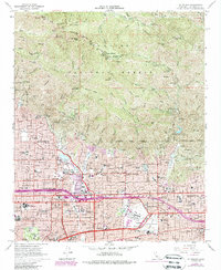
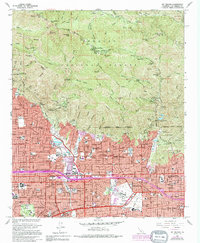
1966 Map of Mt. Wilson
USGS Topo · Published 1974About this map
Mount Wilson stands as the centerpiece of this terrain, dominated by the Observatory, Solar Camera Tower, and various radio installations within the Angeles National Forest. The map documents the dense suburban expansion of the mid-1960s into the foothills, with purple-tinted revisions showing further urban growth by the early 1970s. The landscape transitions sharply from the steep peaks of Mt Harvard and Occidental Peak to the structured street grids of Pasadena and Sierra Madre.
Find a feature on this map
73 named features on this map. Tap any name to fly to it.
Don’t see what you’re looking for? This feature index may not catch every label — zoom into the map to look around manually.
Map Details
Editions of this 1966 Mt. Wilson Map
4 editions found
Other maps of this area

1894 · Los Angeles
USGS Topo · 1:62,500

1894 · Pomona
USGS Topo · 1:62,500

1896 · Pasadena
USGS Topo · 1:62,500

1897 · Pomona
USGS Topo · 1:62,500

1898 · Pomona
USGS Topo · 1:62,500

1900 · Pasadena
USGS Topo · 1:62,500

1900 · Tujunga
USGS Topo · 1:62,500

1900 · Los Angeles
USGS Topo · 1:62,500

1901 · Southern California Sheet No. 1
USGS Topo · 1:250,000

1903 · Rock Creek
USGS Topo · 1:62,500