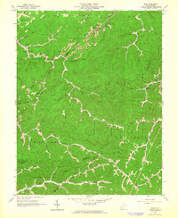
1962 Map of Mud
USGS Topo · Published 1964About this map
Mud River and its intricate network of tributaries define this 1960s landscape, illustrating a period where traditional Appalachian hollow life intersected with a modernizing energy economy. Small settlements and community hubs like Cameo (Garner Sta) and Glowers Ford are surrounded by evidence of active extraction, including numerous strip mines and gas wells. The map reveals a dense social fabric through its distribution of family-named landmarks and institutions, such as Vickers Cem, Smith Cem, and several local schools including Berry Branch Sch and Dolly Sch. In the southern portion, a large pipeline and a Compressor Station underscore the industrial shift occurring alongside older mountain traditions. The complex terrain of Boone Block and the winding course of Ugly Creek show how geography dictated the placement of early roads and jeep trails connecting these remote hollows.
Find a feature on this map
90 named features on this map. Tap any name to fly to it.
Don’t see what you’re looking for? This feature index may not catch every label — zoom into the map to look around manually.
Map Details
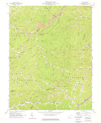
Editions of this 1962 Mud Map
2 editions found
Other maps of this area

1887 · Warfield
USGS Topo · 1:125,000

1891 · Oceana
USGS Topo · 1:125,000

1891 · Warfield
USGS Topo · 1:125,000

1892 · Huntington
USGS Topo · 1:125,000

1893 · Oceana
USGS Topo · 1:125,000

1898 · Huntington
USGS Topo · 1:125,000

1898 · Oceana
USGS Topo · 1:125,000

1899 · Charleston
USGS Topo · 1:125,000

1902 · Midkiff
USGS Topo · 1:62,500

1907 · Midkiff
USGS Topo · 1:62,500