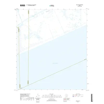
2019 Map of Mud Lake
USGS Topo · Published 2019About this map
The Gulf of Mexico dominates the southern reaches of this coastal landscape where the Texas shoreline meets the marshy transitions of Jefferson, Chambers, and Galveston counties. This environment is defined by its complex hydrology, centered on the expansive Mud Lake and the arterial Intracoastal Waterway, which cuts through the low-lying terrain to support regional maritime transit. Further inland, the drainage pattern is shaped by Mud Bayou and the North Prong Mud Bayou, snaking through wetlands that have historically challenged infrastructure. A prominent remnant of early coastal transit is visible in Old Hwy 87, tracing a route near the water's edge. The map captures a largely uninhabited interface of land and sea, where the vast saltwater expanse meets the delicate freshwater bayou systems of the Texas coast.
Find a feature on this map
9 named features on this map. Tap any name to fly to it.
Don’t see what you’re looking for? This feature index may not catch every label — zoom into the map to look around manually.
Map Details
Editions of this 2019 Mud Lake Map
This is the sole edition of this map. No revisions or reprints were ever made.
Other maps of this area

1931 · High Island
USGS Topo · 1:24,000

1943 · High Island
USGS Topo · 1:31,680

1943 · Sea Breeze
USGS Topo · 1:24,000

1945 · Sea Breeze
USGS Topo · 1:31,680

1950 · Houston
USGS Topo · 1:250,000

1956 · Houston
USGS Topo · 1:250,000

1961 · Star Lake
USGS Topo · 1:24,000

1961 · Mud Lake
USGS Topo · 1:24,000
1962 · High Island
USGS Topo · 1:24,000
1962 · Stanolind Reservoir
USGS Topo · 1:24,000