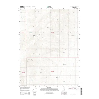
2014 Map of Mud Spring Gulch
USGS Topo · Published 2014About this map
The Shoshone Range dominates this portion of Lander County, Nevada, providing a study in Great Basin landforms and water resource management. Elevation ranges from the heights of Bald Mtn and Granite Mtn down through high-desert drainages such as Slaven Canyon and Mud Spring Gulch. The reliance on limited water sources is evident through the naming of specific points like Filippini Spring Number Three and Mud Spring. Human activity in this territory is primarily represented by the remote Fire Creek Rd and the extensive system of gulches, including Tub Spring Gulch and Rosebud Gulch, which dictate the movement of both water and traveler across the basin. The map illustrates a high-desert environment defined by its naming of peaks like Myers Hill and deep cuts like Black Rock Canyon.
Find a feature on this map
20 named features on this map. Tap any name to fly to it.
Don’t see what you’re looking for? This feature index may not catch every label — zoom into the map to look around manually.
Map Details
Editions of this 2014 Mud Spring Gulch Map
This is the sole edition of this map. No revisions or reprints were ever made.
Other maps of this area

1949 · Crescent Valley
USGS Topo · 1:62,500

1949 · Mt. Lewis
USGS Topo · 1:62,500

1950 · Mt. Lewis
USGS Topo · 1:62,500

1950 · Crescent Valley
USGS Topo · 1:62,500

1955 · Winnemucca
USGS Topo · 1:250,000

1957 · Dunphy
USGS Topo · 1:62,500

1957 · Battle Mountain
USGS Topo · 1:62,500

1958 · Winnemucca
USGS Topo · 1:250,000

1962 · Winnemucca
USGS Topo · 1:250,000

1985 · Mud Spring Gulch
USGS Topo · 1:24,000