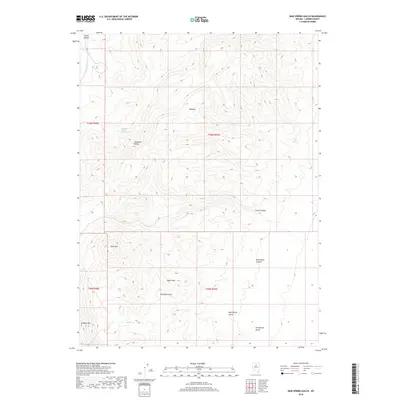
2018 Map of Mud Spring Gulch
USGS Topo · Published 2018About this map
Shoshone Range peaks define this high-elevation landscape in Lander County, where water sources like Filippini Spring Number Three and Mud Spring were critical for survival and land use. The topography is marked by a complex system of drainages, including the prominent Mud Spring Gulch, Rosebud Gulch, and Tub Spring Gulch. These features suggest a history of seasonal water management and livestock movement through the canyons. Notable elevations such as Bald Mtn, Granite Mtn, and Myers Hill provide distinct navigational landmarks across the desert terrain. The presence of Malpais indicates volcanic geological formations that shaped the local environment, while named canyons like Slaven Canyon and Black Rock Canyon offer narrow passages through the mountain range.
Find a feature on this map
19 named features on this map. Tap any name to fly to it.
Don’t see what you’re looking for? This feature index may not catch every label — zoom into the map to look around manually.
Map Details
Editions of this 2018 Mud Spring Gulch Map
This is the sole edition of this map. No revisions or reprints were ever made.
Other maps of this area

1949 · Crescent Valley
USGS Topo · 1:62,500

1949 · Mt. Lewis
USGS Topo · 1:62,500

1950 · Mt. Lewis
USGS Topo · 1:62,500

1950 · Crescent Valley
USGS Topo · 1:62,500

1955 · Winnemucca
USGS Topo · 1:250,000

1957 · Dunphy
USGS Topo · 1:62,500

1957 · Battle Mountain
USGS Topo · 1:62,500

1958 · Winnemucca
USGS Topo · 1:250,000

1962 · Winnemucca
USGS Topo · 1:250,000

1985 · Mud Spring Gulch
USGS Topo · 1:24,000