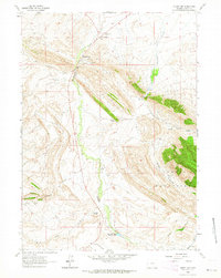
1962 Map of Muddy Gap
USGS Topo · Published 1964About this map
The Red Hills and the Black Ferris Mountains dominate this 1962 terrain, where high-desert hydrology and ranching life intersect. The map records a landscape of strategic passages and remote outposts, centered on the confluence at Muddy Gap Junction and the namesake Muddy Gap. Settlement is defined by functional ranching and family operations, including the Sharp 47 Ranch and the George Tully Homestead.
Find a feature on this map
30 named features on this map. Tap any name to fly to it.
Don’t see what you’re looking for? This feature index may not catch every label — zoom into the map to look around manually.
Map Details
Editions of this 1962 Muddy Gap Map
2 editions found
Other maps of this area

1951 · Savage Peak
USGS Topo · 1:24,000

1951 · Bucklin Reservoirs
USGS Topo · 1:24,000

1951 · Split Rock
USGS Topo · 1:24,000

1955 · Casper
USGS Topo · 1:250,000

1958 · Casper
USGS Topo · 1:250,000

1961 · Lamont NE
USGS Topo · 1:24,000

1961 · Lamont
USGS Topo · 1:24,000

1961 · Bairoil
USGS Topo · 1:24,000

1962 · Casper
USGS Topo · 1:250,000

1962 · Whiskey Peak
USGS Topo · 1:24,000