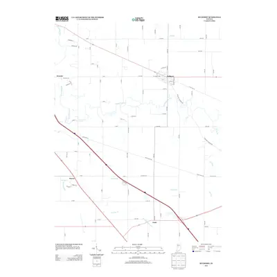
2013 Map of Mulberry
USGS Topo · Published 2013About this map
The town of Mulberry serves as the primary hub of this north-central Indiana landscape, where a dense network of county roads intersects with more recent thoroughfares. The drainage patterns across the terrain are heavily influenced by agricultural engineering, visible in the man-made channels of McClellan Fickle Ditch, Anderson Ditch, and Hentz Ditch. These managed waterways feed into natural systems like the winding S Fork Wildcat Cr and Lauramie Cr. Small settlements such as Monroe, Wyandot, and Fickle are distributed along the road grid, representing the long-standing rural community structure of Clinton County. While the larger transportation corridors suggest modern transit needs, the proximity of traditional watercourses like Hog Run, Spring Cr, and Lick Run indicates the foundational role of the local watershed in the area's development.
Find a feature on this map
70 named features on this map. Tap any name to fly to it.
Don’t see what you’re looking for? This feature index may not catch every label — zoom into the map to look around manually.
Map Details
Editions of this 2013 Mulberry Map
This is the sole edition of this map. No revisions or reprints were ever made.
Other maps of this area

1953 · Danville
USGS Topo · 1:250,000

1955 · Danville
USGS Topo · 1:250,000

1956 · Danville
USGS Topo · 1:250,000

1958 · Kirkpatrick
USGS Topo · 1:24,000

1961 · Mulberry
USGS Topo · 1:24,000

1961 · Pyrmont
USGS Topo · 1:24,000

1961 · Stockwell
USGS Topo · 1:24,000

1961 · Lafayette East
USGS Topo · 1:24,000

1961 · Rossville
USGS Topo · 1:24,000

1961 · Frankfort
USGS Topo · 1:24,000