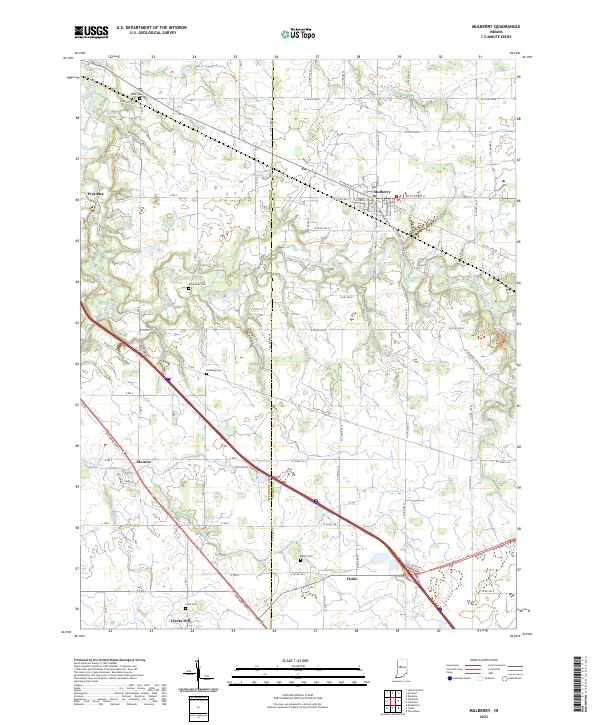
2022 Map of Mulberry
USGS Topo · Published 2022About this map
Mulberry stands at the heart of this Indiana landscape, serving as a hub for the surrounding agricultural communities of Wyandot, Monroe, and Fickle. The terrain is defined by the winding course of the South Fork Wildcat Creek, which carves through the northern portion of the quadrangle near the prominent Kirkridge Bluff. This area, split by the Tippecanoe and Clinton county line, reveals a deeply established rural network of family cemeteries and drainage systems. Genealogists and local historians can trace legacy sites such as Baker Cem, Newcomer Cem, and Holladay Cem, which dot the farmland between the creeks. A complex system of waterways, including Lauramie Cr and several man-made ditches like Hentz Ditch and McClellan Fickle Ditch, underscores the region's long history of land management for farming.
Find a feature on this map
59 named features on this map. Tap any name to fly to it.
Don’t see what you’re looking for? This feature index may not catch every label — zoom into the map to look around manually.
Map Details
Editions of this 2022 Mulberry Map
This is the sole edition of this map. No revisions or reprints were ever made.
Other maps of this area

1953 · Danville
USGS Topo · 1:250,000

1955 · Danville
USGS Topo · 1:250,000

1956 · Danville
USGS Topo · 1:250,000

1958 · Kirkpatrick
USGS Topo · 1:24,000

1961 · Mulberry
USGS Topo · 1:24,000

1961 · Pyrmont
USGS Topo · 1:24,000

1961 · Stockwell
USGS Topo · 1:24,000

1961 · Lafayette East
USGS Topo · 1:24,000

1961 · Rossville
USGS Topo · 1:24,000

1961 · Frankfort
USGS Topo · 1:24,000