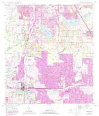
1949 Map of Mulberry
USGS Topo · Published 1988About this map
Phosphate mining dominates the landscape of Polk County in the mid-20th century, where a massive network of extractive sites surrounds the community of Mulberry. The terrain is characterized by extensive Strip Mine operations and subsequent reclaimed strip mines, reflecting the industrial scale of the region's mineral wealth. This industrial activity sits alongside established rural settlements like Medulla and Highland City, where local life is anchored by landmarks such as the Medulla Cem and Providence Ch.
Find a feature on this map
44 named features on this map. Tap any name to fly to it.
Don’t see what you’re looking for? This feature index may not catch every label — zoom into the map to look around manually.
Map Details
Editions of this 1949 Mulberry Map
5 editions found
Other maps of this area

1944 · Plant City
USGS Topo · 1:31,680

1944 · Lakeland
USGS Topo · 1:31,680

1944 · Auburndale
USGS Topo · 1:31,680

1949 · Mulberry
USGS Topo · 1:24,000

1949 · Bartow
USGS Topo · 1:24,000

1949 · Bradley Junction
USGS Topo · 1:24,000

1950 · Mulberry
USGS Topo · 1:24,000

1950 · Bartow
USGS Topo · 1:24,000

1950 · Bradley Junction
USGS Topo · 1:24,000

1952 · Homeland
USGS Topo · 1:24,000