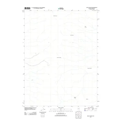
2012 Map of Mule Canyon
USGS Topo · Published 2012About this map
The Shoshone Range dominates this portion of Lander County, where high-desert drainages and broad basins define the landscape. This 2012 survey illustrates a topography of steep canyons and open flats, notably where Mule Canyon and Water Canyon cut through the western slopes. To the east, the terrain opens into the expansive Whirlwind Valley, a geographical feature typical of the Great Basin’s alternating mountain and valley structure. Other named high points and basins, such as Horse Heaven and the volcanic-associated Malpais, suggest a landscape historically shaped by ranching and natural resource exploration. The map records the sparse network of dirt roads and trails that navigate these landforms, providing a detailed view of the remote corridors between the Shoshone peaks and the valley floor.
Find a feature on this map
7 named features on this map. Tap any name to fly to it.
Don’t see what you’re looking for? This feature index may not catch every label — zoom into the map to look around manually.
Map Details
Editions of this 2012 Mule Canyon Map
This is the sole edition of this map. No revisions or reprints were ever made.
Other maps of this area

1949 · Crescent Valley
USGS Topo · 1:62,500

1949 · Mt. Lewis
USGS Topo · 1:62,500

1950 · Mt. Lewis
USGS Topo · 1:62,500

1950 · Crescent Valley
USGS Topo · 1:62,500

1955 · Winnemucca
USGS Topo · 1:250,000

1957 · Dunphy
USGS Topo · 1:62,500

1957 · Battle Mountain
USGS Topo · 1:62,500

1958 · Winnemucca
USGS Topo · 1:250,000

1962 · Winnemucca
USGS Topo · 1:250,000

1985 · Mud Spring Gulch
USGS Topo · 1:24,000