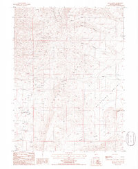
1985 Map of Mule Canyon
USGS Topo · Published 1986About this map
Bante Mine and Miller Mine define the industrial footprint of this Nevada landscape in the mid-1980s. The terrain is dominated by the steep ridges of the Shoshone Range, which gives way to the broader expanses of Whirlwind Valley to the east and south. This map reflects a period of intensive resource exploration, evidenced by numerous prospects and open pit mines scattered across the high desert topography. Several deep drainages, including Deer Canyon, Mule Canyon, and Slaven Canyon, carve through the range, while isolated springs and radio towers mark the few points of human infrastructure in this remote area. The southern portion of the sheet includes the curiously named Horse Heaven, situated above the volcanic flows of the Malpais.
Find a feature on this map
18 named features on this map. Tap any name to fly to it.
Don’t see what you’re looking for? This feature index may not catch every label — zoom into the map to look around manually.
Map Details
Editions of this 1985 Mule Canyon Map
This is the sole edition of this map. No revisions or reprints were ever made.
Other maps of this area

1949 · Crescent Valley
USGS Topo · 1:62,500

1949 · Mt. Lewis
USGS Topo · 1:62,500

1950 · Mt. Lewis
USGS Topo · 1:62,500

1950 · Crescent Valley
USGS Topo · 1:62,500

1955 · Winnemucca
USGS Topo · 1:250,000

1957 · Dunphy
USGS Topo · 1:62,500

1957 · Battle Mountain
USGS Topo · 1:62,500

1958 · Winnemucca
USGS Topo · 1:250,000

1962 · Winnemucca
USGS Topo · 1:250,000

1985 · Mud Spring Gulch
USGS Topo · 1:24,000