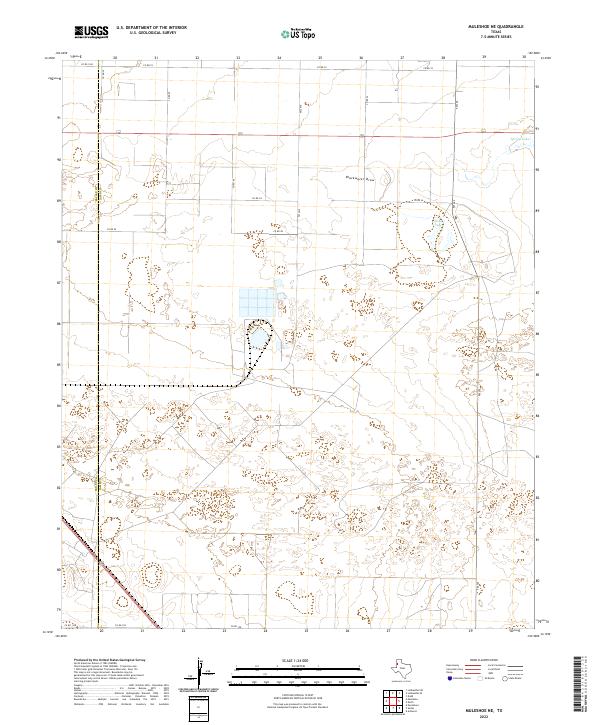
2022 Map of Muleshoe NE
USGS Topo · Published 2022About this map
Blackwater Draw cuts across this High Plains landscape, serving as a primary topographic feature in a region defined by its wide, semi-arid stretches. The area is marked by distinctive hydrological formations including the ephemeral basin of Soda Lake and the water source at Spring Lake in the northeastern corner. This 2022 survey documents a late-modern agricultural and ranching grid, where the county line between Bailey Co and Lamb Co bisects the western portion of the map. The network of rural routes, such as FM 303 and FM 2910, connects isolated homesteads and irrigation sites, reflecting the systematic land division typical of the Texas Panhandle. The map reveals the intricate contouring around low-lying draws and depressions that are critical for local water management in this livestock-heavy territory.
Find a feature on this map
16 named features on this map. Tap any name to fly to it.
Don’t see what you’re looking for? This feature index may not catch every label — zoom into the map to look around manually.
Map Details
Editions of this 2022 Muleshoe NE Map
This is the sole edition of this map. No revisions or reprints were ever made.
Other maps of this area

1954 · Clovis
USGS Topo · 1:250,000

1958 · Clovis
USGS Topo · 1:250,000

1962 · Muleshoe
USGS Topo · 1:24,000

1962 · Needmore
USGS Topo · 1:24,000

1962 · Amherst
USGS Topo · 1:24,000

1962 · Sudan
USGS Topo · 1:24,000

1962 · Muleshoe NE
USGS Topo · 1:24,000

1963 · Earth
USGS Topo · 1:24,000

1963 · Dodd
USGS Topo · 1:24,000

1963 · Lazbuddie SW
USGS Topo · 1:24,000