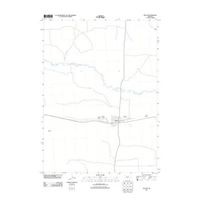
2011 Map of Mullen
USGS Topo · Published 2011About this map
The Middle Loup River meanders across this Sandhills landscape, defining the hydrology north of the village of Mullen. This 2011 survey captures the area's role as a ranching and transportation hub in Hooker County. The concentrated settlement of Mullen is anchored by the Mullen Post Office and the Hooker County Fair Grounds, while the Hooker County Airport and a network of rural routes like Fairground Rd connect the town to the surrounding countryside. Large-scale ranching operations, such as Morris Ranch and Lee Boyer Ranch, illustrate the region's agricultural character. Genealogists and local historians can locate the Cedarview Cemetery on the eastern edge of town, along with rural access points like Co Rd P108.
Find a feature on this map
10 named features on this map. Tap any name to fly to it.
Don’t see what you’re looking for? This feature index may not catch every label — zoom into the map to look around manually.
Map Details
Editions of this 2011 Mullen Map
This is the sole edition of this map. No revisions or reprints were ever made.
Other maps of this area

1947 · Dismal River Ranch
USGS Topo · 1:62,500

1948 · Seneca
USGS Topo · 1:62,500

1948 · Mullen
USGS Topo · 1:62,500

1949 · Dismal River Ranch
USGS Topo · 1:62,500

1950 · Shimmins Lake
USGS Topo · 1:62,500

1951 · Mullen
USGS Topo · 1:62,500

1951 · Seneca
USGS Topo · 1:62,500

1954 · North Platte
USGS Topo · 1:250,000

1956 · North Platte
USGS Topo · 1:250,000

1957 · North Platte
USGS Topo · 1:250,000