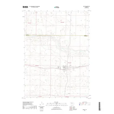
2017 Map of Mullen
USGS Topo · Published 2017About this map
Mullen serves as the focal point of this Nebraska Sandhills survey, situated just south of the winding Middle Loup River. The landscape is defined by its characteristic high-relief dune topography, with the town's grid stretching from N Veteran Ave to S Laird Ave. Local infrastructure is well-defined, including the Hooker County Airport and the outlying Cedarview Cem to the east. The river valley provides a distinct corridor through the otherwise undulating terrain, marked by the administrative boundary where Cherry Co meets Hooker Co to the north. Transportation patterns are anchored by the east-west corridor passing through the heart of the settlement, supported by local routes such as Heritage Rd and Fairground Rd.
Find a feature on this map
22 named features on this map. Tap any name to fly to it.
Don’t see what you’re looking for? This feature index may not catch every label — zoom into the map to look around manually.
Map Details
Editions of this 2017 Mullen Map
This is the sole edition of this map. No revisions or reprints were ever made.
Other maps of this area

1947 · Dismal River Ranch
USGS Topo · 1:62,500

1948 · Seneca
USGS Topo · 1:62,500

1948 · Mullen
USGS Topo · 1:62,500

1949 · Dismal River Ranch
USGS Topo · 1:62,500

1950 · Shimmins Lake
USGS Topo · 1:62,500

1951 · Mullen
USGS Topo · 1:62,500

1951 · Seneca
USGS Topo · 1:62,500

1954 · North Platte
USGS Topo · 1:250,000

1956 · North Platte
USGS Topo · 1:250,000

1957 · North Platte
USGS Topo · 1:250,000