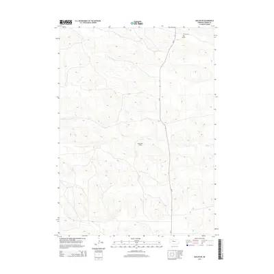
2014 Map of Mullen NE
USGS Topo · Published 2014About this map
The undulating sandhills of Cherry County dominate this 2014 survey, where the seasonal hydrology of the region is traced through the meandering path of Calf Cr. This ephemeral waterway carves out the Calf Creek Valley, providing a distinct geographic break in the otherwise continuous dune topography. Human presence in this section of the Nebraska interior is sparse, defined primarily by the corridor of Ne-97 and the secondary route of Dry Valley Rd. The map illustrates the characteristic landscape of the northern Dry Valley, showing how modern infrastructure adapts to the natural basins and valleys formed by the region's unique geology.
Find a feature on this map
5 named features on this map. Tap any name to fly to it.
Don’t see what you’re looking for? This feature index may not catch every label — zoom into the map to look around manually.
Map Details
Editions of this 2014 Mullen NE Map
This is the sole edition of this map. No revisions or reprints were ever made.
Other maps of this area

1948 · Seneca
USGS Topo · 1:62,500

1948 · Mullen
USGS Topo · 1:62,500

1949 · Big Falls
USGS Topo · 1:62,500

1951 · Mullen
USGS Topo · 1:62,500

1951 · Seneca
USGS Topo · 1:62,500

1951 · Big Falls
USGS Topo · 1:62,500

1951 · Bull Lake
USGS Topo · 1:62,500

1957 · Valentine
USGS Topo · 1:250,000

1959 · Valentine
USGS Topo · 1:250,000

1985 · Mullen
USGS Topo · 1:100,000