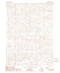
1987 Map of Mullen NE
USGS Topo · Published 1988About this map
The undulating Nebraska Sandhills define this corner of Cherry Co, where the landscape is sculpted by expansive depressions and shallow drainage systems. Recorded during a mid-1980s provisional survey, the terrain shows the characteristic local patterns of the High Plains, most notably the broad expanse of Calf Creek Valley stretching across the central portion of the sheet. To the northeast, the aptly named Dry Valley further illustrates the region's complex hydrology and wind-carved topography. This map captures the area as it was managed across township lines, specifically the transition between T25N and T26N, where ranch roads and unimproved trails are the primary indicators of human presence in this sparse, open rangeland.
Find a feature on this map
4 named features on this map. Tap any name to fly to it.
Don’t see what you’re looking for? This feature index may not catch every label — zoom into the map to look around manually.
Map Details
Editions of this 1987 Mullen NE Map
This is the sole edition of this map. No revisions or reprints were ever made.
Other maps of this area

1948 · Seneca
USGS Topo · 1:62,500

1948 · Mullen
USGS Topo · 1:62,500

1949 · Big Falls
USGS Topo · 1:62,500

1951 · Mullen
USGS Topo · 1:62,500

1951 · Seneca
USGS Topo · 1:62,500

1951 · Big Falls
USGS Topo · 1:62,500

1951 · Bull Lake
USGS Topo · 1:62,500

1957 · Valentine
USGS Topo · 1:250,000

1959 · Valentine
USGS Topo · 1:250,000

1985 · Mullen
USGS Topo · 1:100,000