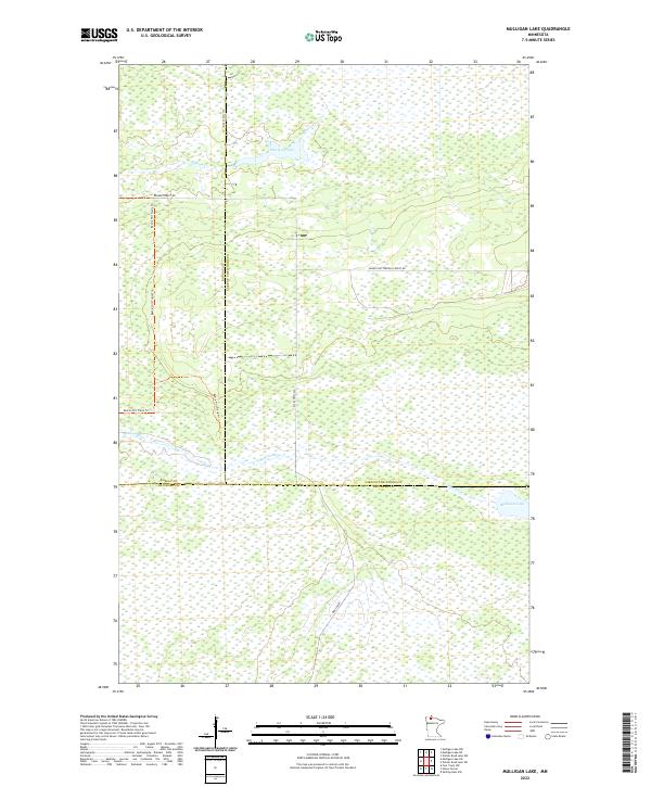
2022 Map of Mulligan Lake
USGS Topo · Published 2022About this map
Mulligan Lake anchors the southeastern corner of this northern Minnesota landscape, a region defined by intricate wetlands and sprawling forest tracts. The terrain is marked by the meeting of three counties—Lake of the Woods, Roseau, and Beltrami—and is largely shaped by the meandering courses of the Roseau River and Hansen Creek. Human infrastructure is sparse and oriented toward timber and recreation, consisting primarily of forest roads and multi-use paths. Remote access ways like Dicks Pkwy SW and Winner Forest Rd cut through the boggy lowland, while the Bemis Hill Trails Trl provides a dedicated route for navigating the interior woods. This survey illustrates the modern management of a vast wilderness area where township lines like t159n r37w and t159n r36w overlay a landscape of primary drainage and heavy forest cover.
Find a feature on this map
16 named features on this map. Tap any name to fly to it.
Don’t see what you’re looking for? This feature index may not catch every label — zoom into the map to look around manually.
Map Details
Editions of this 2022 Mulligan Lake Map
This is the sole edition of this map. No revisions or reprints were ever made.
Other maps of this area

1918 · Winterroad
USGS Topo · 1:62,500

1918 · F
USGS Topo · 1:62,500

1918 · Malcolm
USGS Topo · 1:62,500

1954 · Roseau
USGS Topo · 1:250,000

1957 · Roseau
USGS Topo · 1:250,000

1958 · Roseau
USGS Topo · 1:250,000

1968 · Mulligan Lake SW
USGS Topo · 1:24,000
1968 · Mulligan Lake NE
USGS Topo · 1:24,000
1968 · Winter Road Lake NW
USGS Topo · 1:24,000
1968 · Mulligan Lake NW
USGS Topo · 1:24,000