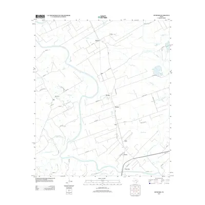
2013 Map of Mumford
USGS Topo · Published 2013About this map
The Brazos River meanders across this landscape north of Bryan, defining a region where river bottomlands meet established farming communities. The settlement of Mumford serves as a focal point near the northern edge, supported by the nearby Mumford Cem and a network of agricultural roads like Foyt Rd. The map reveals a transition from the structured plots of Teal Prairie and Rita in the west to the wetlands of the east, where Red Slough and Sims Slough dictate the local geography. Small rail-side and roadside hamlets such as Mooring, Mudville, Sims, and Varisco are linked by FM 50, illustrating a traditional rural Texas settlement pattern. Notable landmarks including the Varisco Airport and the community of Stone City highlight the intersection of mid-century infrastructure and long-standing river-dependent localities.
Find a feature on this map
55 named features on this map. Tap any name to fly to it.
Don’t see what you’re looking for? This feature index may not catch every label — zoom into the map to look around manually.
Map Details
Editions of this 2013 Mumford Map
This is the sole edition of this map. No revisions or reprints were ever made.
Other maps of this area

1954 · Austin
USGS Topo · 1:250,000
1956 · Bryan
USGS Topo · 1:62,500
1956 · Caldwell
USGS Topo · 1:62,500
1961 · Caldwell
USGS Topo · 1:24,000
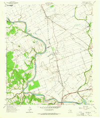
1961 · Mumford
USGS Topo · 1:24,000
1961 · Hearne South
USGS Topo · 1:24,000
1962 · Goodwill
USGS Topo · 1:24,000
1962 · Tunis
USGS Topo · 1:24,000
1962 · Gause
USGS Topo · 1:24,000
1962 · Chances Store
USGS Topo · 1:24,000