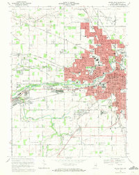
1969 Map of Muncie West
USGS Topo · Published 1971About this map
Muncie and its western suburbs expand along the banks of the White River in this late-1960s survey. The institutional footprint of Ball State University dominates the central landscape, surrounded by a dense network of neighborhoods and civic landmarks like the County Fairgrounds and Ball Memorial Hospital. To the west, the village of Yorktown sits at the junction of the Penn Central and Norfolk And Western railroads, maintaining a distinct identity even as suburban growth from the city pushes outward.
Find a feature on this map
105 named features on this map. Tap any name to fly to it.
Don’t see what you’re looking for? This feature index may not catch every label — zoom into the map to look around manually.
Map Details
Editions of this 1969 Muncie West Map
3 editions found
Other maps of this area

1952 · Muncie East
USGS Topo · 1:24,000

1952 · Muncie West
USGS Topo · 1:24,000

1953 · Muncie
USGS Topo · 1:250,000

1956 · Muncie
USGS Topo · 1:250,000

1960 · Gilman
USGS Topo · 1:24,000

1960 · Middletown
USGS Topo · 1:24,000

1960 · Eaton
USGS Topo · 1:24,000

1960 · Mount Pleasant
USGS Topo · 1:24,000

1960 · Wheeling
USGS Topo · 1:24,000

1960 · Sulphur Springs
USGS Topo · 1:24,000