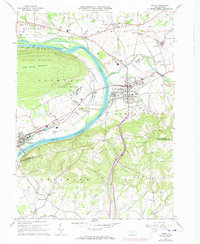
1965 Map of Muncy
USGS Topo · Published 1973About this map
The West Branch Susquehanna River carves a sharp path through Lycoming County, separating the steep slopes of Bald Eagle Mountain from the developed agricultural and industrial lowlands of Muncy. This mid-century landscape is defined by its heavy infrastructure, including the large State Correctional Institution complex and the Muncy Valley Hospital. The river corridor is a hub of transport, dominated by the Reading and Penn Central rail lines that service settlements like Montgomery and Muncy Station.
Find a feature on this map
57 named features on this map. Tap any name to fly to it.
Don’t see what you’re looking for? This feature index may not catch every label — zoom into the map to look around manually.
Map Details
Editions of this 1965 Muncy Map
4 editions found
Other maps of this area

1924 · Milton
USGS Topo · 1:62,500

1927 · Eagles Mere
USGS Topo · 1:48,000

1930 · Warrensville
USGS Topo · 1:62,500

1932 · Eagle Mere
USGS Topo · 1:62,500

1934 · Warrensville
USGS Topo · 1:62,500

1935 · Hughesville
USGS Topo · 1:62,500

1953 · Hughesville
USGS Topo · 1:62,500

1953 · Warrensville
USGS Topo · 1:62,500

1953 · Eagles Mere
USGS Topo · 1:62,500

1953 · Milton
USGS Topo · 1:62,500
Featured Places
- Lewis Township, PA
- Delaware Run, Delaware Township
- Muncy, PA
- Muncy Creek Township, PA
- Clinton Township, PA